We slept well the previous night, not even noticing when the rains rolled in, but we woke to a damp tent and I’m afraid that the foot of my sleeping bag was even wetter than normal.
Off we set, heading more inland than normal. The village of Agon-Countainville seemed in fact to be a sprawling collection of little villages with huge areas of pastureland between them. Each seemed to have its own church, so perhaps the area is subdivided into parishes.
On our way out of town we passed an enormous stone cross with the crucified Christ on it. We have passed many of these and they are all identical. What they mark we haven’t yet discovered, they don’t have inscriptions on them. There are also many tiny crosses that look like they are poured concrete. Each stands about six feet high on a pyramidal base with hexagonal crosspieces. These too have no inscriptions. From their military air I am assuming they make the site of a WWII death, but that’s only conjecture.
We passed out of town and down into a valley, where I couldn’t help but laugh at the sign advertising the local protestant “culte.” At the top of the next hill we rejoined the road we had followed the night before, not entirely without incident, however, as we climbed the wrong exit ramp and had to cross against traffic to get on the correct side. When we did we saw a beautiful view. To the north and south of us were lush green pasturelands, dotted about with the spires of churches. West of us and directly below was a long sandy estuary leading out to the sea. All this filtered through a beautiful veil of white mist. Unfortunately we had to bike out into that mist. We, in fact, pedaled off into the rain quite comfortably. What eventually drove us to exhaustion was the never ceasing wind.
We biked down into the valley of the estuary to discover it belonged to a small river called the Seine. Crossing the Seine, at least it used to cross the Seine, was a bridge that had suffered at the hands of the allies in WWIII.

After the invasion of Normandy the allies had tried to isolate the German troops on the Cotentin Peninsula. The Pont De La Roque had remained the “hole in the net” that prevented the achievement of the allied goal and over twenty bombing raids had been flown to knock down the three central arches of the bridge, and it wasn’t that large of a bridge. A Canadian pilot had lost his life trying to bomb the structure. All the effort had been in vain anyway as the Germans simply bypassed the area completely. It was a unique experience for us to come over a hill and see a bombed out bridge and a Canadian flag flying. There is a far greater memory of Canadian deeds here than at home.
Apparently, at least according to the sign, we have been following “La Rue de la Liberation” for some time without being aware of it. The memory of the world wars is much more urgent here, in the fields were they were fought, than at home, whatever our contributions might have been.
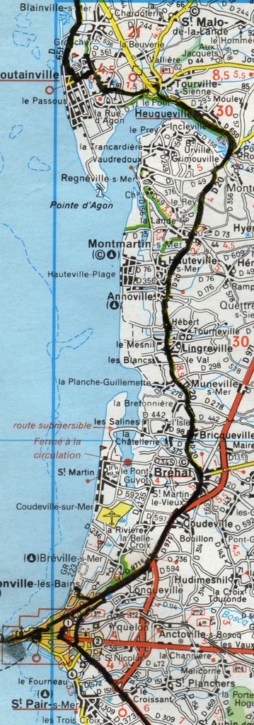
Biking got harder as the day progressed. Every time we seemed to get into a groove we hit a strong wind that threw us off until it was impossible to maintain a rhythm. Our goal for the day was the city of Granville, or more accurately, its suburb of Donneville-Les-Bains, be we shortened it to the town of Brehal when we became exhausted. Funny thing about Brehal was that it was the only town around that didn’t seem to have a campground. So, we plunked ourselves under the overhanging veranda of the post office and ate lunch sheltered from the rain. But we couldn’t sleep under the shelter of the post office and so we set out on the last little bit to Granville.
The road was a major one and the volume of traffic was very unsettling but before long we reach the city. Now to find a campground. We passed the sign for one on the way in and followed it’s arrow, but found nothing. As it was Sunday the tourist office was closed and there were no maps around. We followed the main road until it turned into Granville and went down a long hill, definitely not the way we wanted to go. We turned back, feeling a little despairing, and suddenly found a map. It was on the back of a bus sheltered, mostly covered by a hedge. Why the local’s thought the hedges would get lost I don’t know but we soon got our bearings. With only one further mishap, finding a graveyard instead of our campground, we found the campsite.
We pitched our tent under the miniscule shelter of a windswept pine and Heather huddled in the wind and rain to cook our dinner. It was an interesting sight, her kneeling over a tiny flame, rain pouring off her, wind whipping at her jacket, all for a few heated sausages and some sauerkraut. What a dedicated woman.
But the wind passed from being funny to being serious very quickly. The walls of the tent were pulsating and every so often a strong gust would almost bend the tent in half. The tent had been built to withstand abnormal weather but why risk it. I found a place more sheltered but we had already unpacked everything and every time I made up my mind to move the wind let off. Still if it keeps up I predict a difficult night and very little sleep.
Next Entry: Day 56. Granville
Previous Entry: Day 54. Agon-Coutainville
No comments:
Post a Comment